2D Diagrams
2020
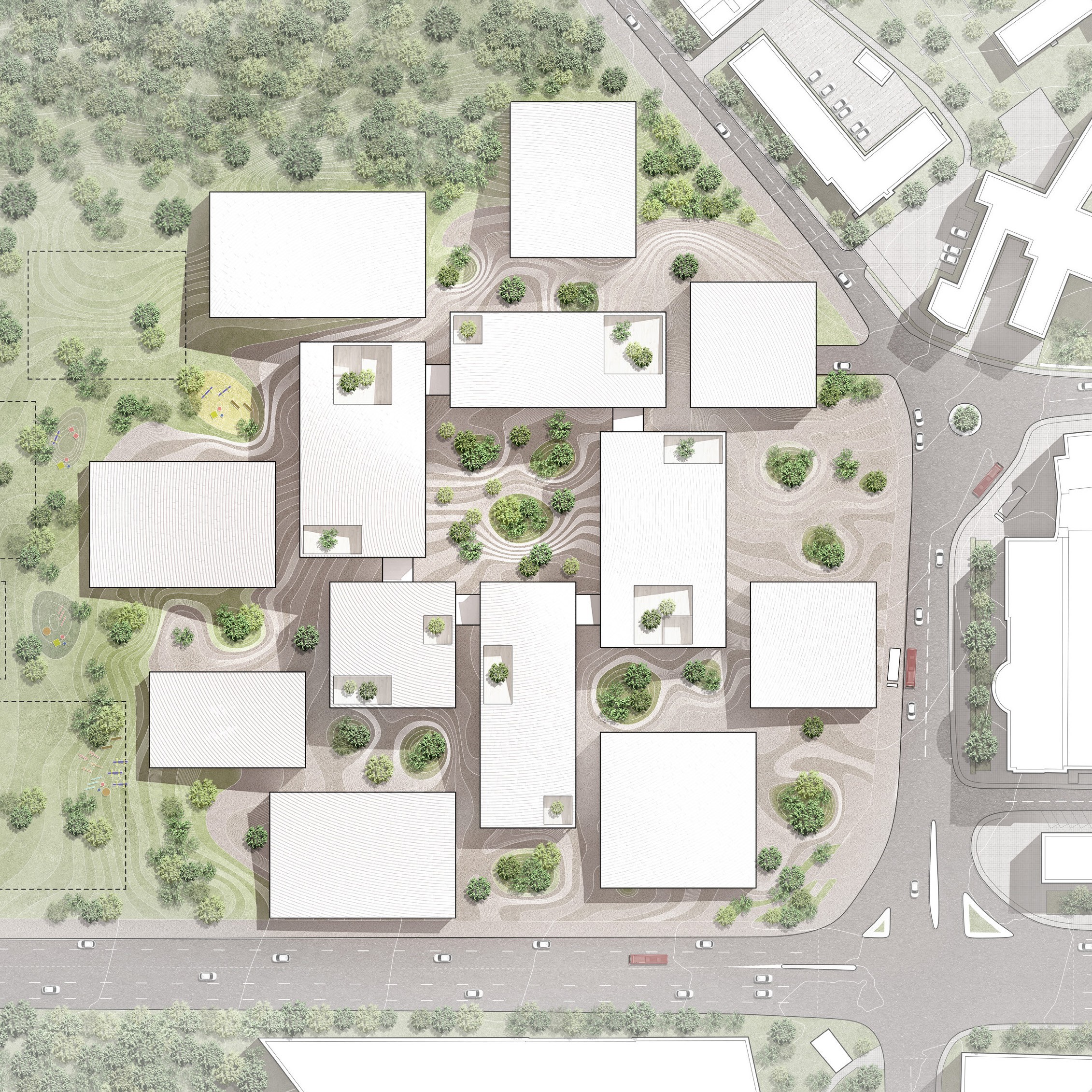
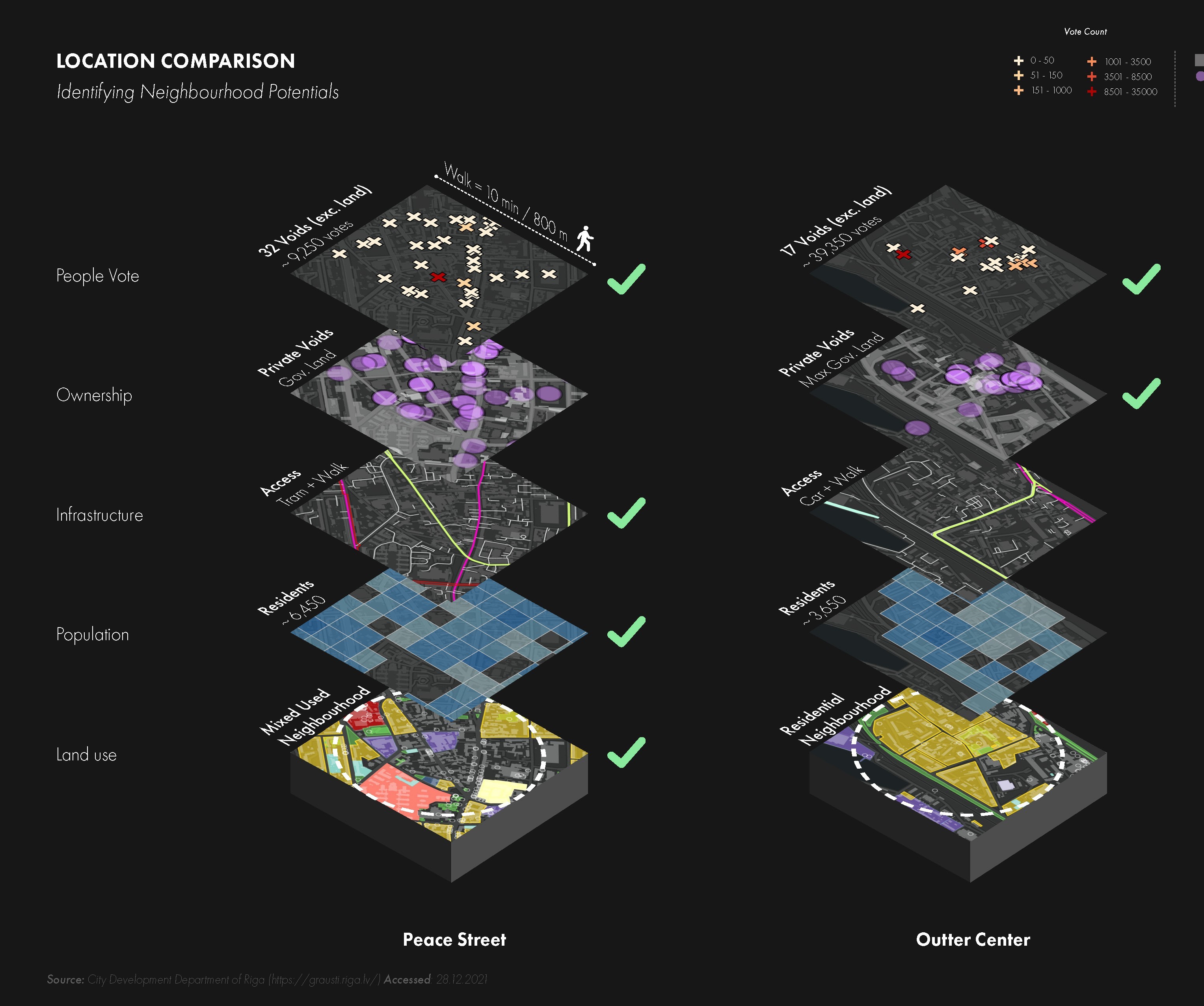
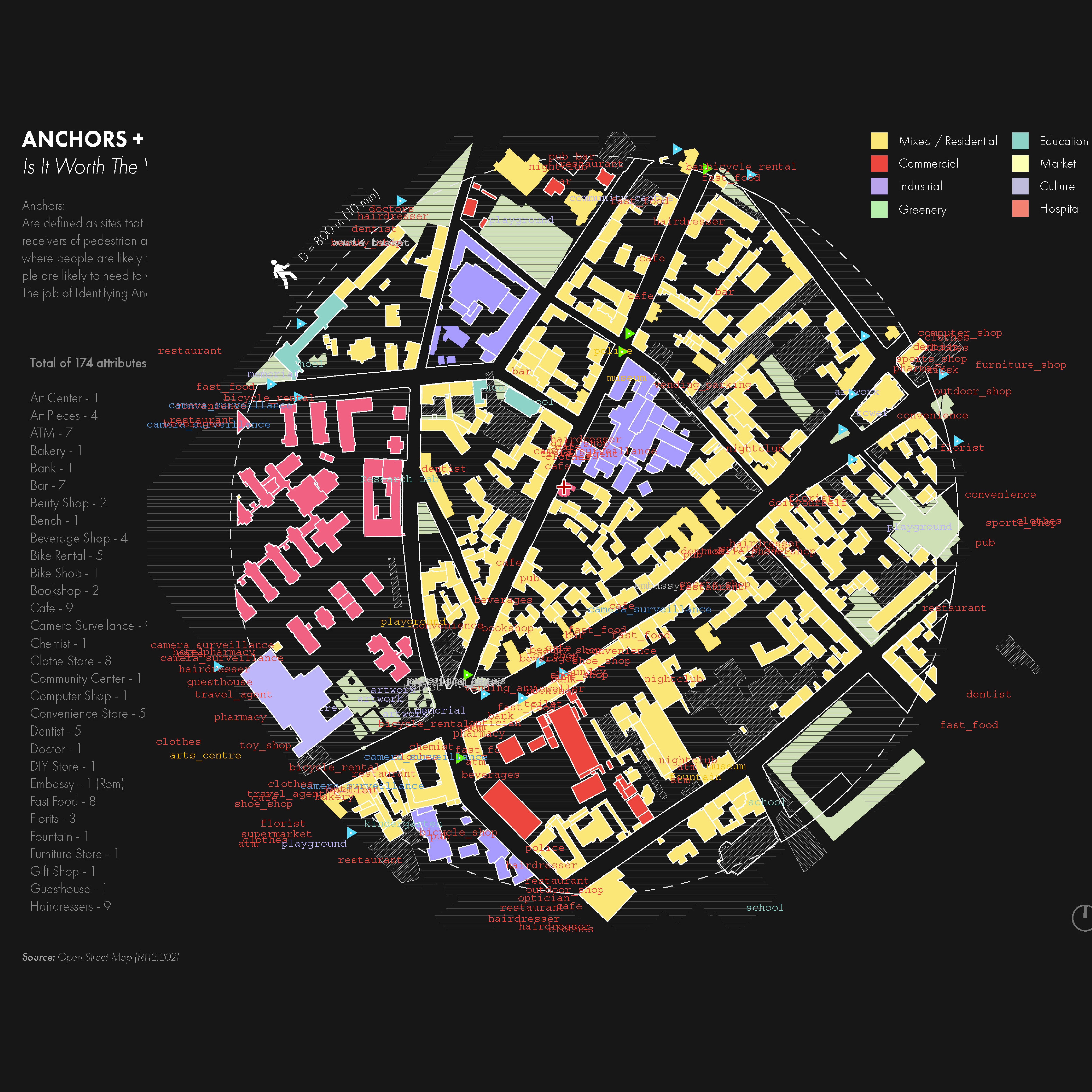
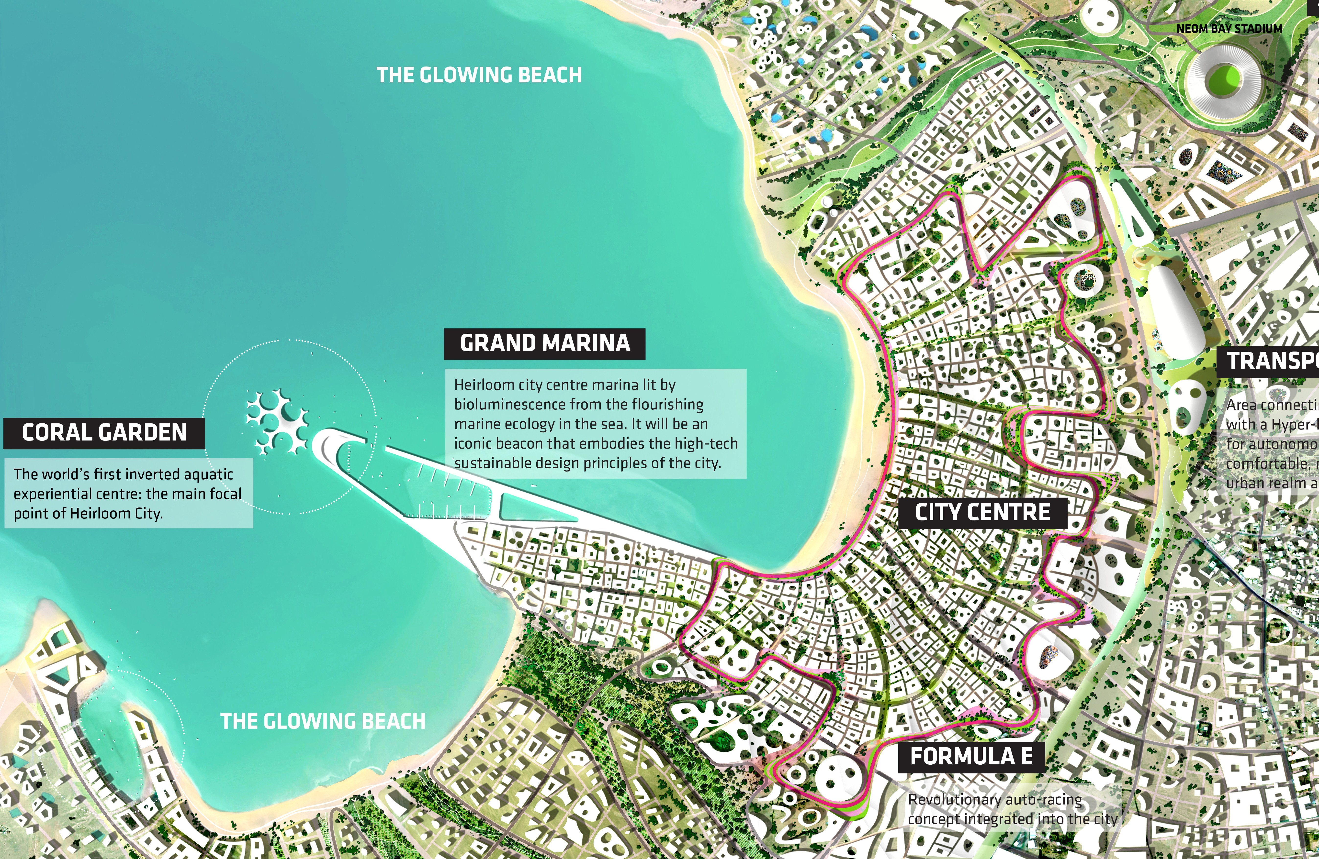
Technical Drawings and GIS Site Analysis
We transform complex urban data into actionable graphics. From detailed site plans to comprehensive neighbourhood studies, our 2D technical drawings provide the foundation for informed architectural decisions.
Advanced GIS Mapping Solutions
Using ArcGIS and precision drafting tools, we create site intelligence beyond basic surveys. Our analysis overlays land use data, infrastructure networks, and urban context, helping architects understand their projects at every scale.
Strategic Design Intelligence
These aren't documentation exercises but strategic tools for smarter design decisions. Our technical drawings reveal how proposals integrate within broader urban fabric.
Partner with our studio for site analysis that drives better architectural outcomes. Reach out👋